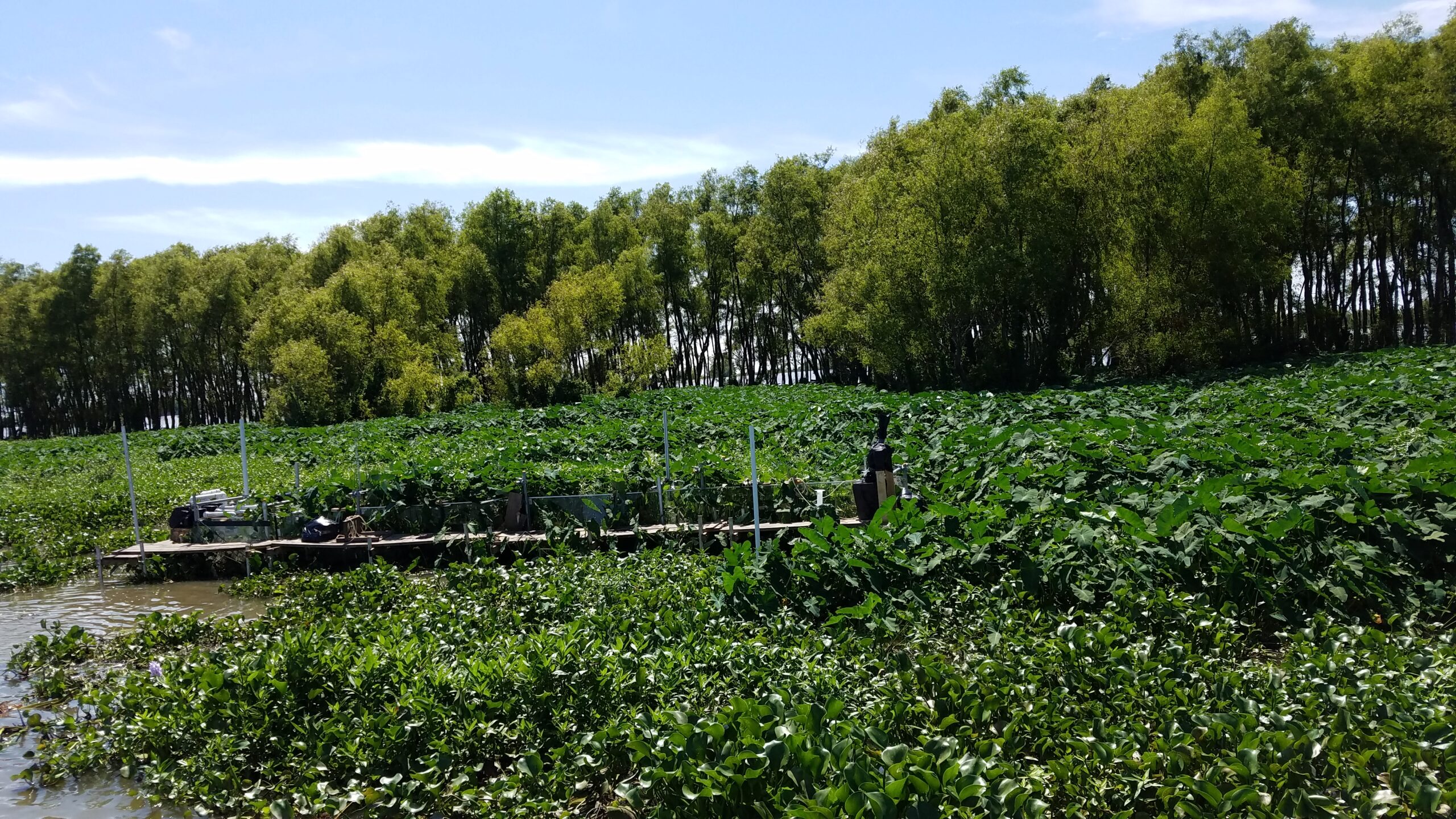
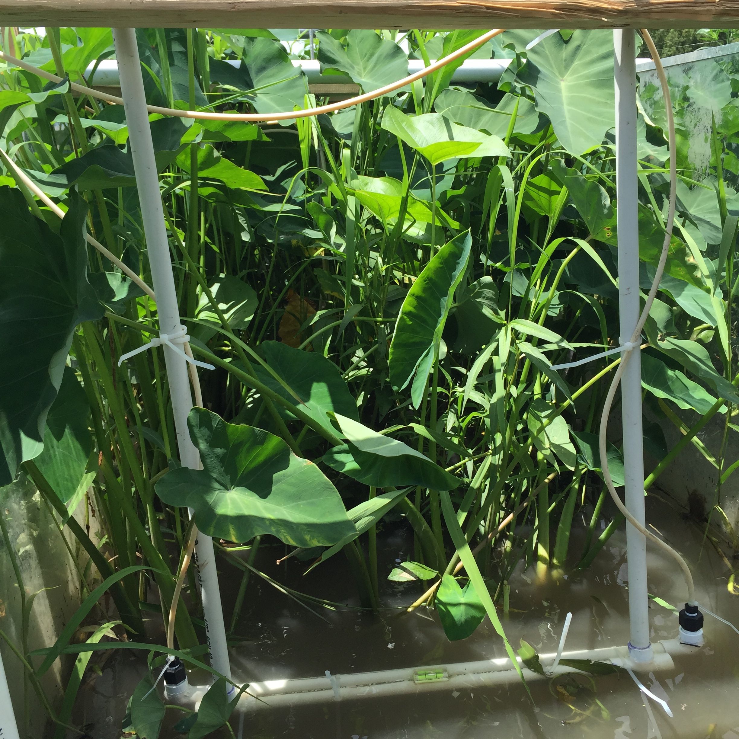
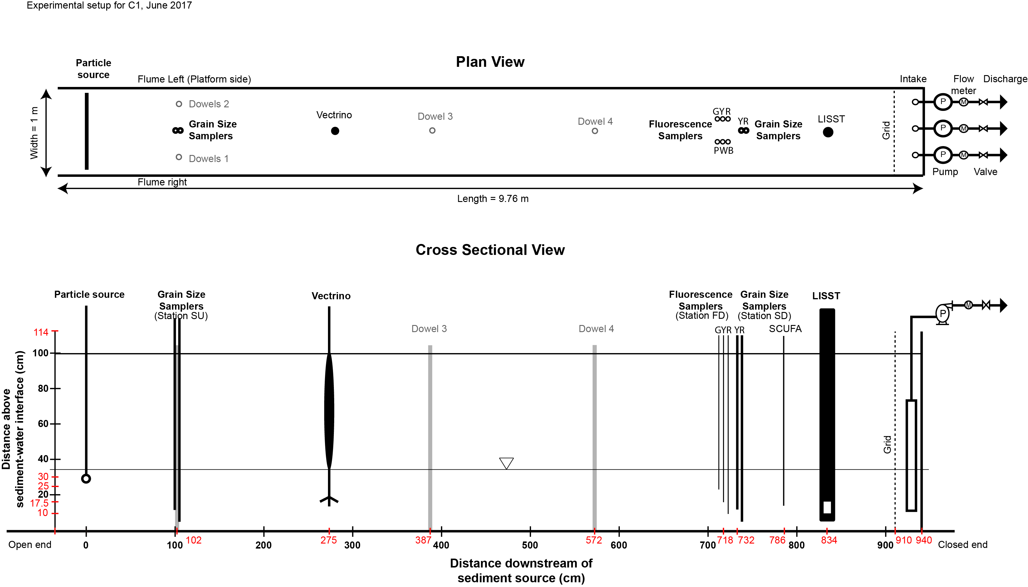
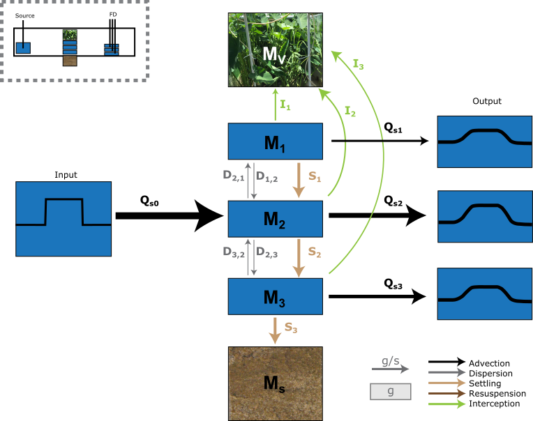
Impact of vegetation on the retention of fine-grained sediments
This project is an attempt to understand how emergent vegetation (and changes in vegetation) influence sedimentation, either through direct interception or by enhancing settling of suspended sediment. This project use experiments conducted on Wax Lake Delta in southern Louisiana in 2017 by Laurel Larsen.
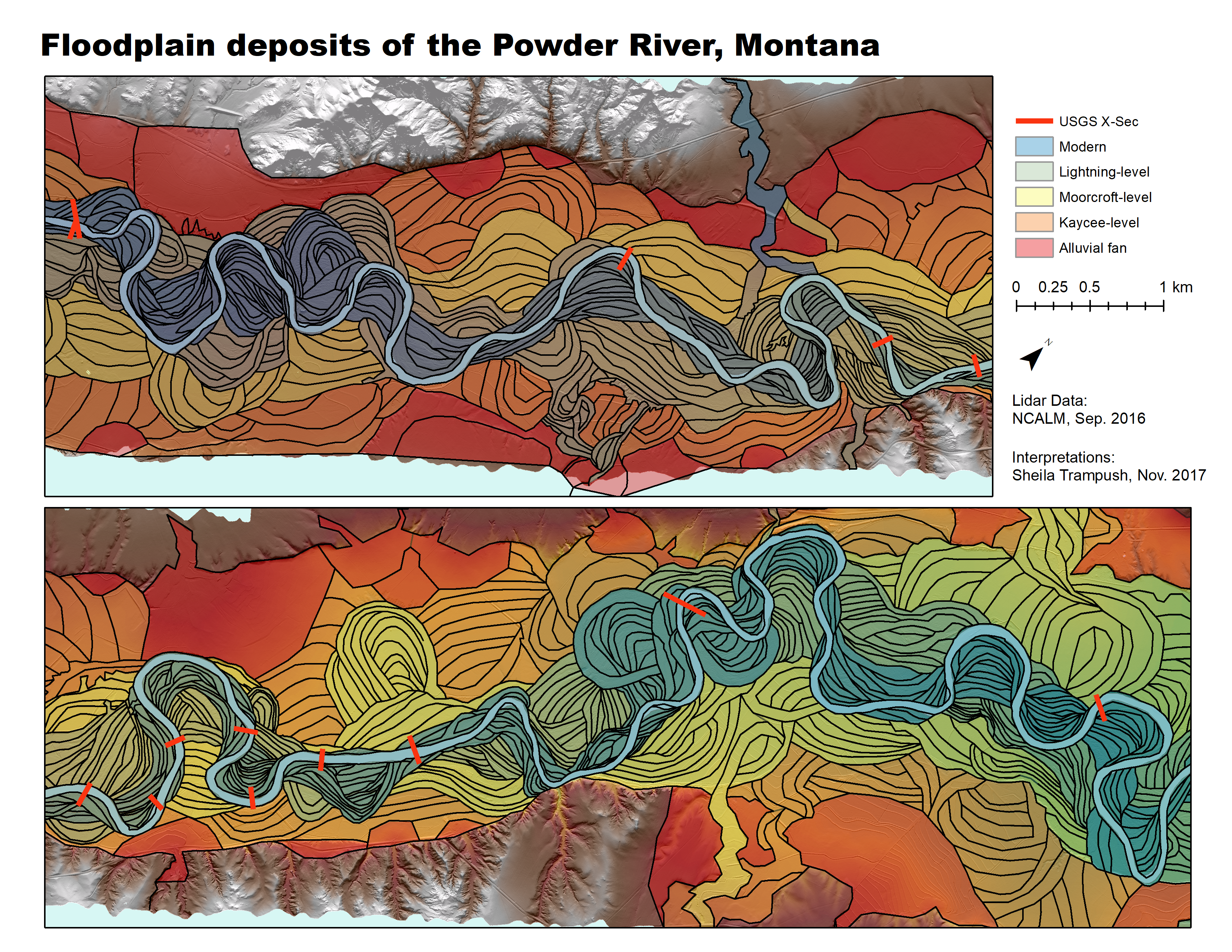
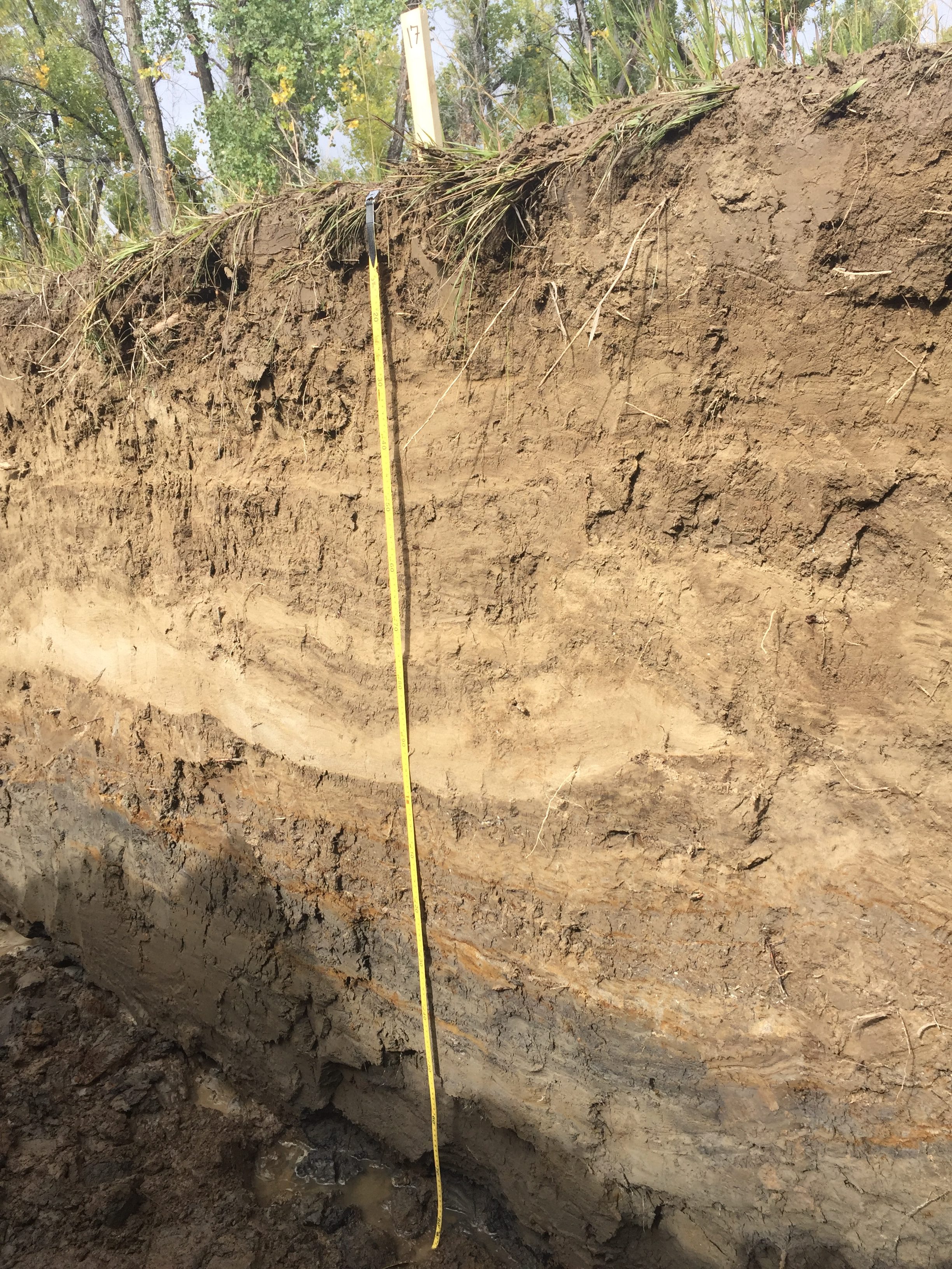
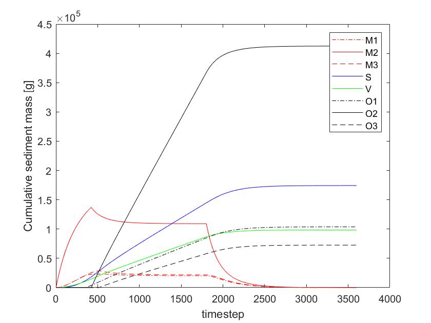
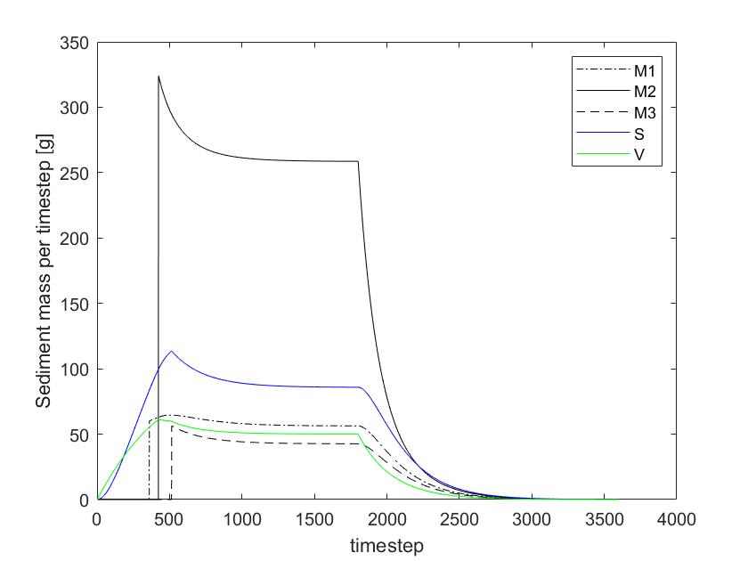
Storage of sediment in the floodplains of meandering rivers
This project is an attempt to understand what controls the residence time of sediment deposited within the floodplain of meandering rivers. It is a joint modeling and field-based project (specifically, modern sediments from the Powder River, MT) that I'm working on with Jim Pizzuto. This project ultimately will help understand how floodplains can filter sediment pulse signals from the uplands or act as long-term reservoirs for contaminants.
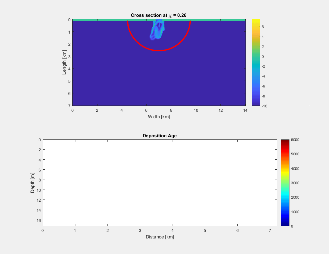
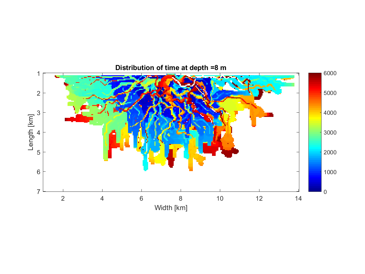
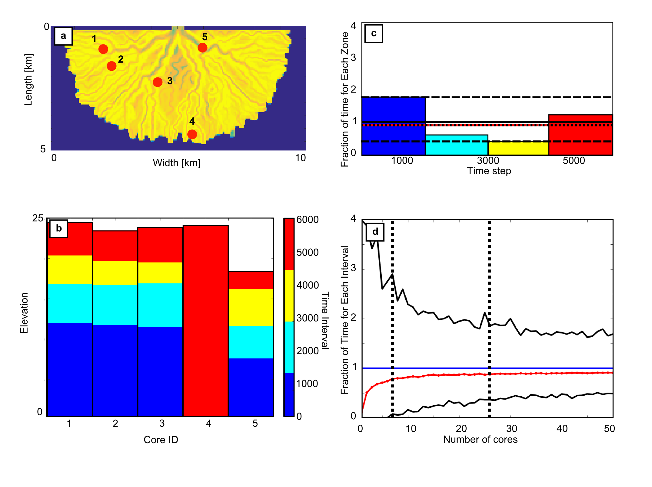
Sampling a complete record in the presence of strong landscape dynamics
Landscape dynamics control where sediment is preserved. Any one location will have large gaps in the record, which means that if you want to reconstruct past signals of, for example, climate change, we need multiple locations for records. This project was to try to predict how many 1D records are needed relative to the scale of the fluvio-deltaic system to reconstruct a complete and unbiased record of time.
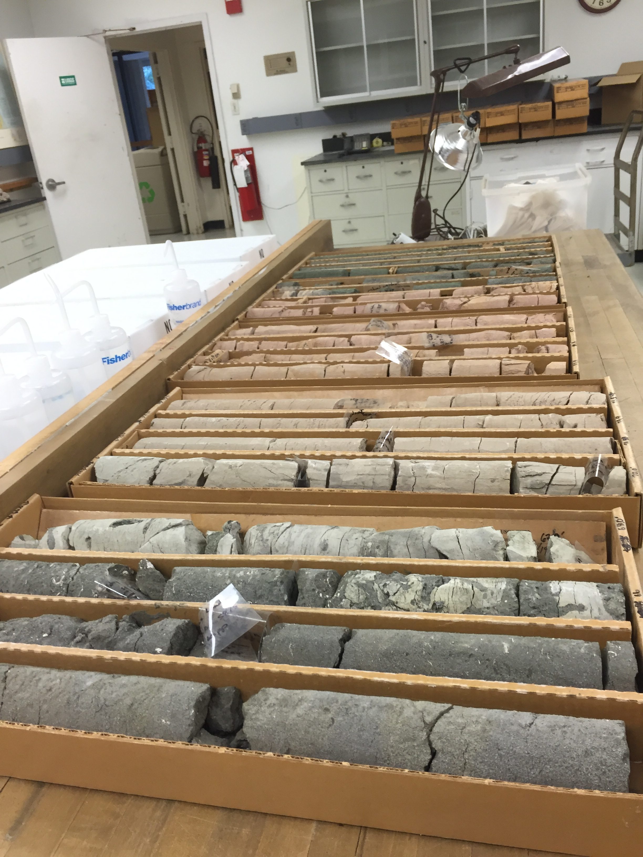
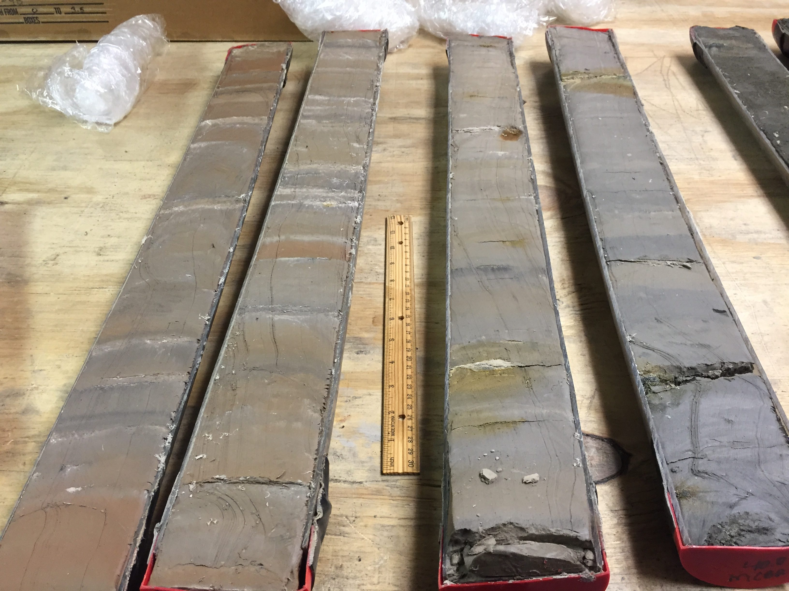
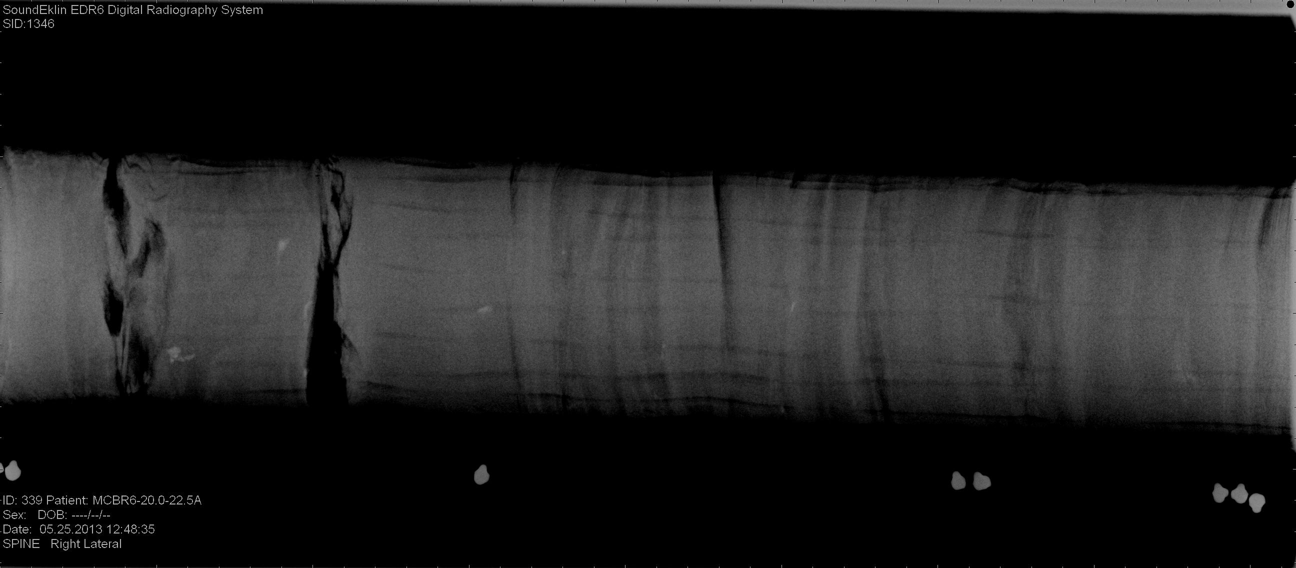
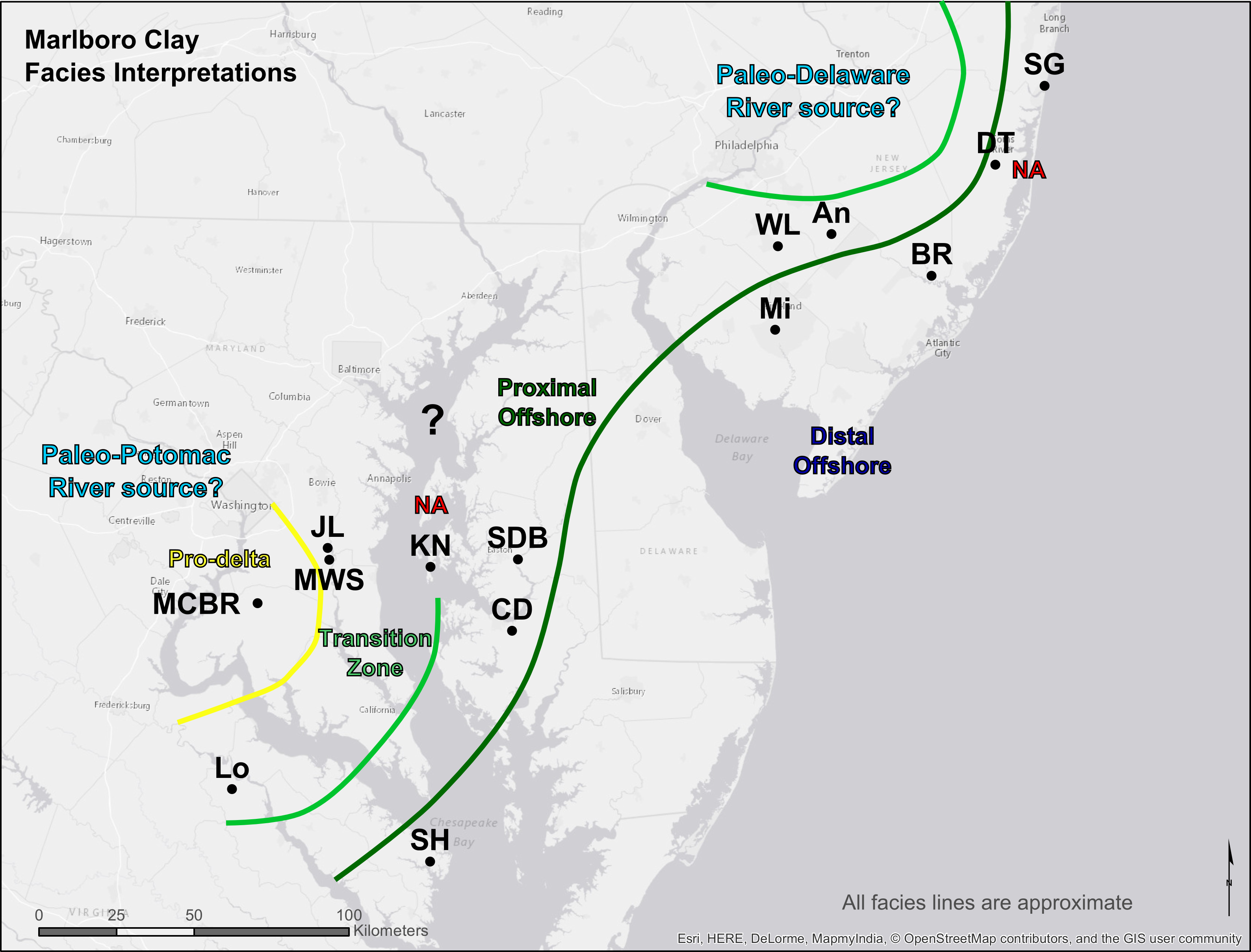
Reconstructing the history of landscape response to the PETM in the Mid-Atlantic
The Peloecene-Eocene Thermal Maximum was a period of rapid global warming in response to carbon entering the atmosphere that occured ~56 Ma. As such it is the closest ancient analog we have to modern global climate change. In the Salisbury Embayment (Maryland, Virginia, Delaware, and New Jersey) the PETM is marked by an extensive sheet of clay called the Marlboro Clay that likely represented a progradation of a deltaic prodelta facies that occurred despite an apparent eustatic sea level rise. This project was to detail the stratigraphic evidence of this landscape response using cores collected across the embayment.
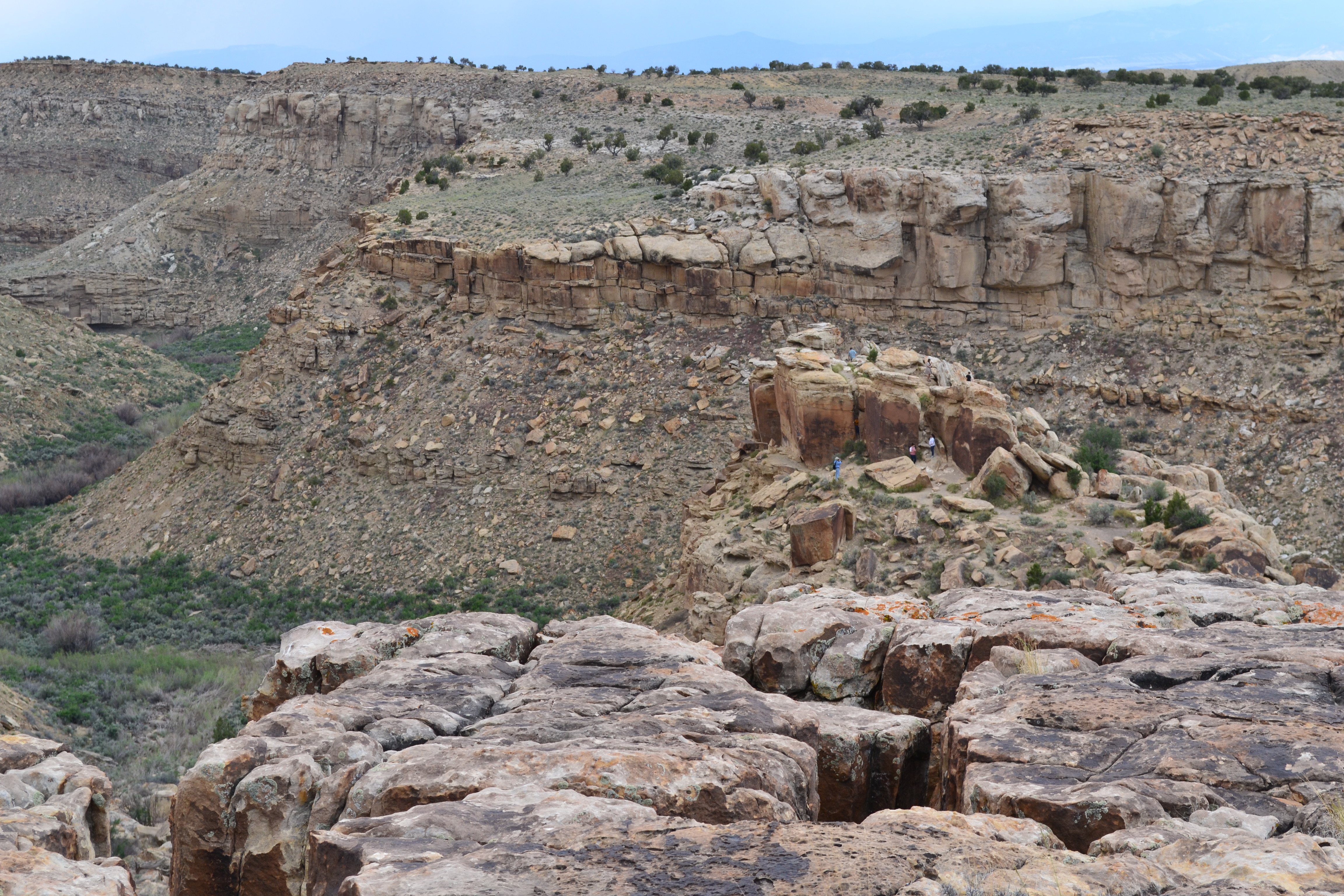
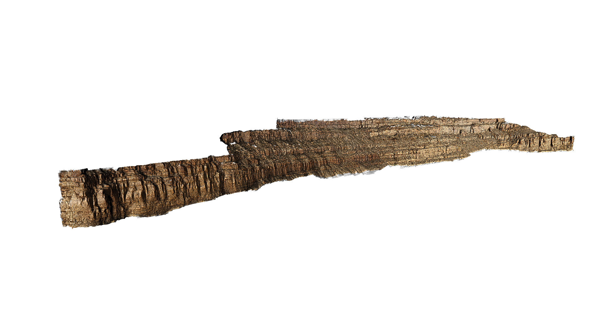
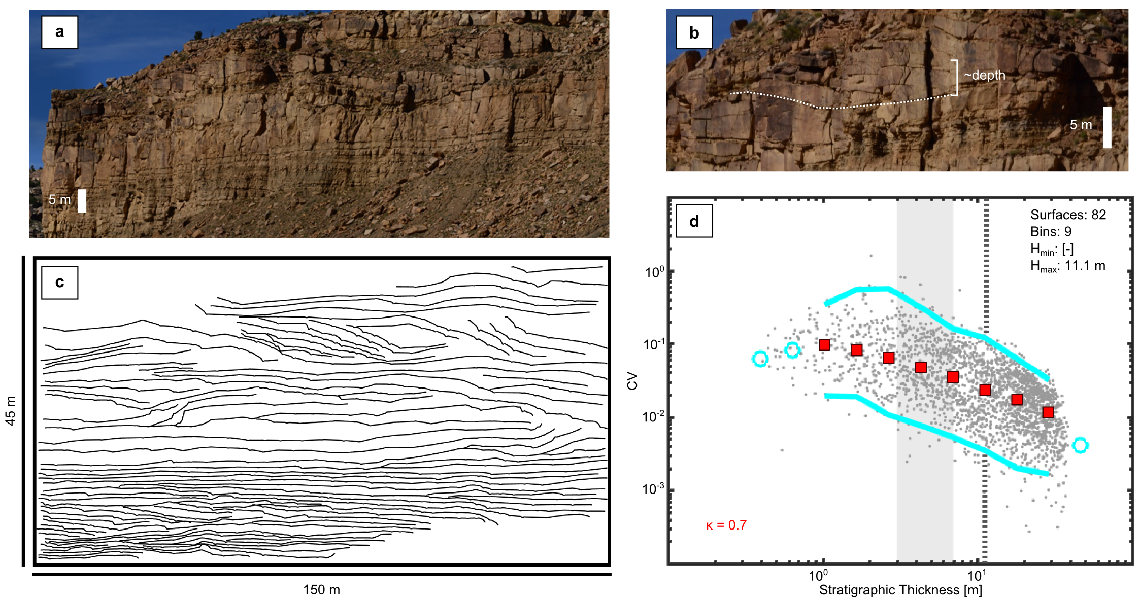


Landscape Dynamics from Stratigraphic Organization
Bed surfaces and stratigraphic architecture contain an amazing amount of information about the evolution of ancient landscapes. Simply by mapping important surfaces on outcrops (using terrestrial lidar, structure-from-motion photogrammatry, or simple photomosaics) and applying tools like the compensation statistic or the k-function point process statistic, we can constrain how processes like avulsion shaped individual landscapes and how those processes changed over time or across space. My analysis using experimental data have shown that these tools are amazingly robust, even in the presence of limited or low-resolution data. Next steps include testing how robust the 1D versions of these tools are.

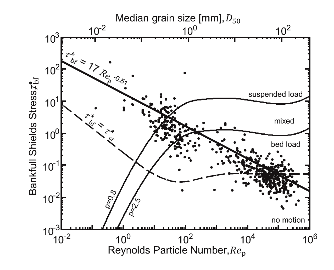
Reconstructing the paleoslope of the Jurassic Morrison Formation using modern bankfull hydrailic relationships
The Jurassic Morrison Formation occurs right before widespread indications of the Sevier Orogeny, and as such was a target to see if the paleoslope of the river system changed throughout it's deposition. In order to better constrain the paleoslope, I used modern data to define a relationship between bankfull water depth, bedload grain size, and bed slope. It turns out that the slope of the Morrison rivers does not noticably change, but the relationship from modern rivers and the database used to construct it has proven to be useful outside of my original application,